This proposed listing forms part of the draft Cardiff Local Heritage List - Public Houses, Hotels and Clubs (current and former)
Building reference
25 Kings CastleDate
Between 1877 and 1898.Ward
RiversideHistory
The King’s Castle is said to have been established in 18891 and named after ‘an ancient building which stood a short distance further east (1866)’.2
This eponymous building is visible in the Budgen map of 1811 and was, in fact, located some way to the north of the extant pub, as first indicated within the tithe map of 1846 (where it is identified as ‘House Y Croft’, owned by the Chapter of Llandaff and occupied by Henry Martin).
The earliest OS map of 1877 shows the same building as a Public House (King’s Castle), with a smithy attached to the west, and gardens (and other outbuildings) to the north. However, the census of 1881 identifies the property as ‘King’s Castle House’ occupied by Edward Cross, Ironmonger (with six family members and two servants).
Archival evidence also suggests a private residence (of the same name) prior to this date, with leases for ‘King’s Castle’ dating back as far as 1781. There is a photo of ‘King’s Castle House, Cowbridge’ dated 1880 available in Glamorgan Archive and a further image showing ‘the family sitting outside King’s Castle House’ in c1890. The building was demolished in 1892 to make way for the Davies Memorial Hall.
The extant building first appears within the OS map of 1901 (revised 1898-99) and is labelled as a public house by the OS of 1920 (revised 1915).
1 The Illustrated History of Cardiff Pubs.
2 ‘The older inns of Cardiff’, in Cardiff Records: Volume 5, ed. John Hobson Matthews (Cardiff, 1905), pp. 438-445.
Description
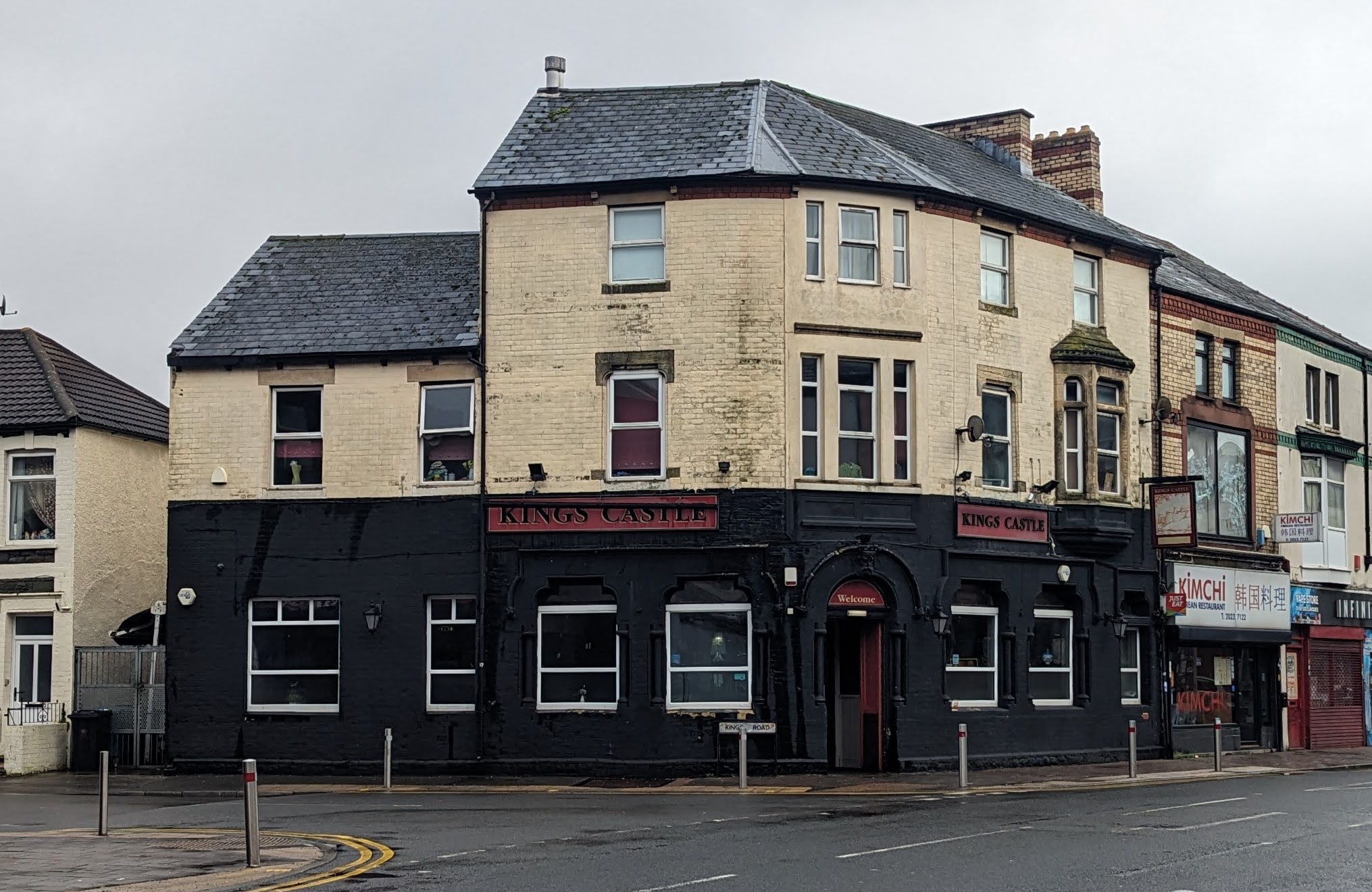
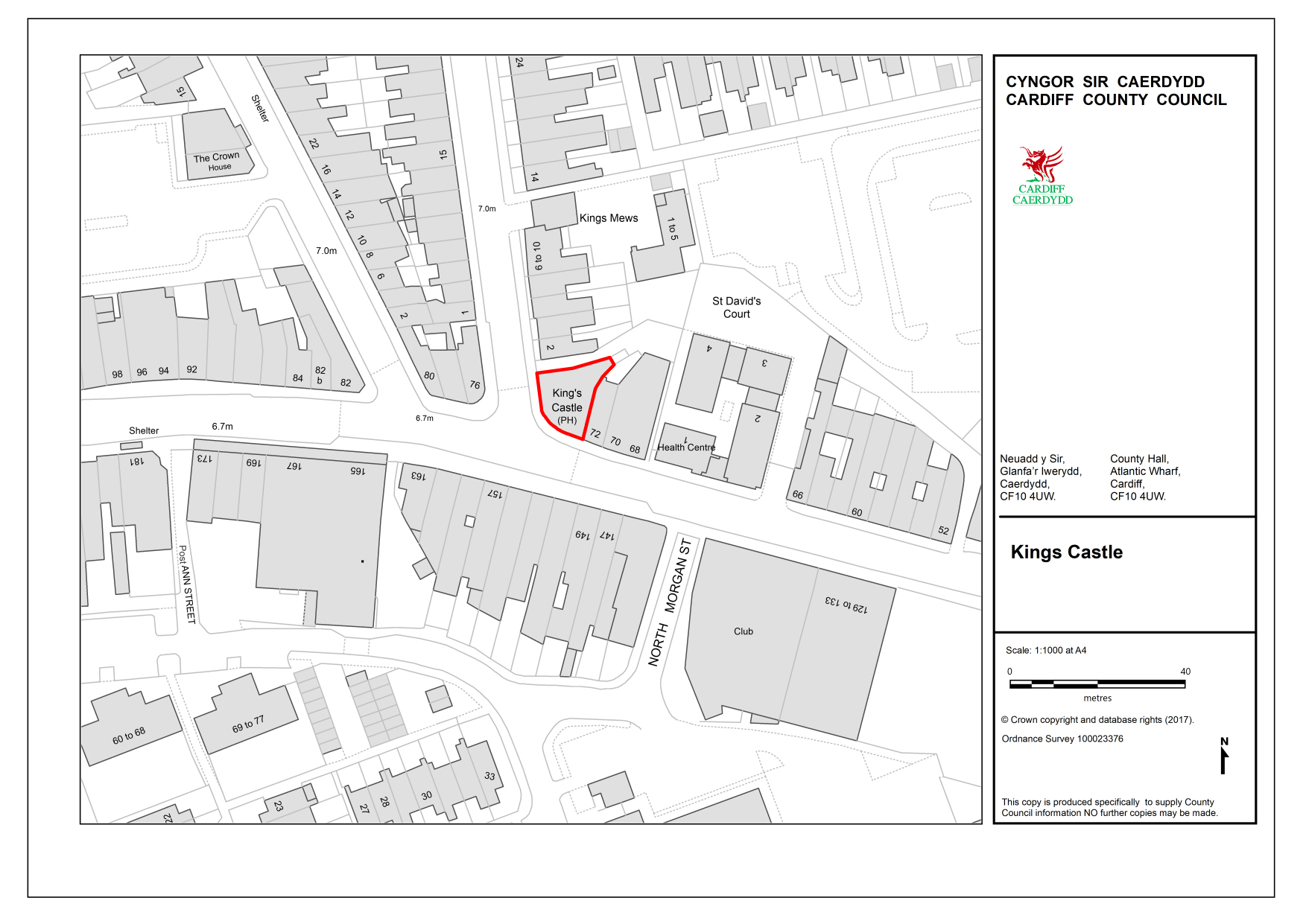
Prominently located on the corner of Kings Road and Cowbridge Road East, with an approximate L-Plan form (with rounded corner to the junction).
The building is primarily of three storeys and formed in brick, ornamented with stone dressings. Painted black at ground floor, the principal three-storey portion has openings with stone surrounds, featuring colonettes supporting moulded heads, further topped with head moulds (with foliate-stops). Windows have concaved shouldered heads and the principal entrance (to the corner) had a semi-circular head with a ‘King’s Head’ keystone.
The upper storeys are less ornate, save for a stone oriel window with crenelated parapet to the southern (Cowbridge Road East) elevation. There are corbelled brick (and stone) eaves, with a slated and pitched gabled roof.
To the north, a plain two-storey brick wing fronts onto King’s Road. uPVC windows throughout.
Reason
A prominently located public house with some rich ornamental details (Aesthetic Value).
There is some Historical Value associated with this later-constructed building which has been in service for some 130 years and also imparts considerable Communal Value.
References
Glamorgan Archives
BC/S/X/96
1851 – Tracing of Ordnance Survey plan 1851 of area extending from Maindy Bridge south to Quay Street; King’s Castle PH, Cowbridge Road, east to west edge of Cathays Park, and to Crockherbtown [Queen Street] and Windsor Street
D532/29/18
C1890 – Photograph of King’s Castle house and family sitting on lawn
DBJ/409-410
1781-1823 – Leases of King’s Castle
DMTH/202/27/1
16 Aug 1799 – Mortgage (Release (Lease for a year missing) in trust, for £60.
(i) Thomas Wilson of Cardiff, yeoman (nephew and devisee in remainder of the premises, names in Will of Alex. Purcel of Cardiff, goldsmith, decd.) and w. Eliz.; to (ii) Richard Rice Williams and Wyndham Lewis, both of Cardiff, gents.; and (iii) Thomas Charles of Cardiff, gent. Land (27a. 2r. 20p.), formerly in occ. of Wm Jones, blacksmith, now of William Westmacutt, lying opposite the King’s Castle;
DX254/27/17
King’s Castle House, Cowbridge Road
1880 – photograph. The house was demolished in 1892. Re-development of the site included the Davies Memorial Hall
DX254/25/2
Cowbridge Road, looking east past the King’s Castle
1900-1910
1 copy of photograph
Additional images
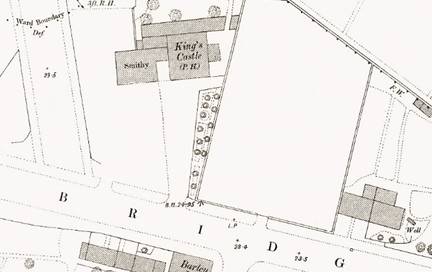
1880 OS Map showing empty site with King’s Castle to the north
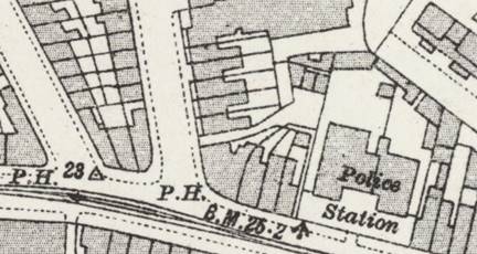
1920 OS Map (surveyed 1915)
