This proposed listing forms part of the draft Cardiff Local Heritage List - Public Houses, Hotels and Clubs (current and former)
Building reference
63 The Deri InnDate
1970s public house possibly with remains of an earlier (pre-1811) farmhouse at its core.Ward
RhiwbinaHistory
In 1801, the population of the whole parish (Whitchurch) was less than 700. The population of Rhiwbina (or ‘Rhyd-y-Walla’ as it was called then) would have been no more than 70-100 persons. They would have been living in one of the five or six local farms, or scattered cottages nearby.
Earliest evidence for a building on this site comes with the Budgen Map of 1811, which shows it occupied by a farmstead called ‘Deri’. The tithe map of 1840 has better detail; showing a large farmhouse directly upon the site of the extant public house, part of the homestead farm of Deri (also then known as ‘Tir Pudur’). The landowner was Sir Charles Morgan 3rd Baronet – making it part of the vast Tredegar Estate. Deri Farm was occupied by Mrs Richard Lewis and comprised of 156 acres, including the nearby Mill (after which Heol-y-Felin now takes its name).
The site appears little changed by the OS of 1886 (surveyed 1875-81). There was a small area of mixed woodland to the north (against the junction of Wenallt Road), gardens directly to the south of the house (separating it from the farm buildings and yard) and an orchard beyond.
By 1898, the farmyard complex had expanded, shown in greater detail within the OS of 1919. Here, the form of the house can also be seen more clearly, as an agglomeration of four principal parts.
This arrangement remained until the Second World War, though the the OS map of 1946 (surveyed 1941-2) shows the expansion of suburban Cardiff rapidly encroaching.
Said to have been built in the 1970s,1 the Deri Inn can, in fact, be seen within the OS of 1967. Judging by its location (and the form of the extant building), it seems the Deri Inn incorporated at least part of the former farmhouse (also see DCONC/6/40a-m). Further site investigation will best confirm this theory.
1 Wales Online 26/11/2011
Description
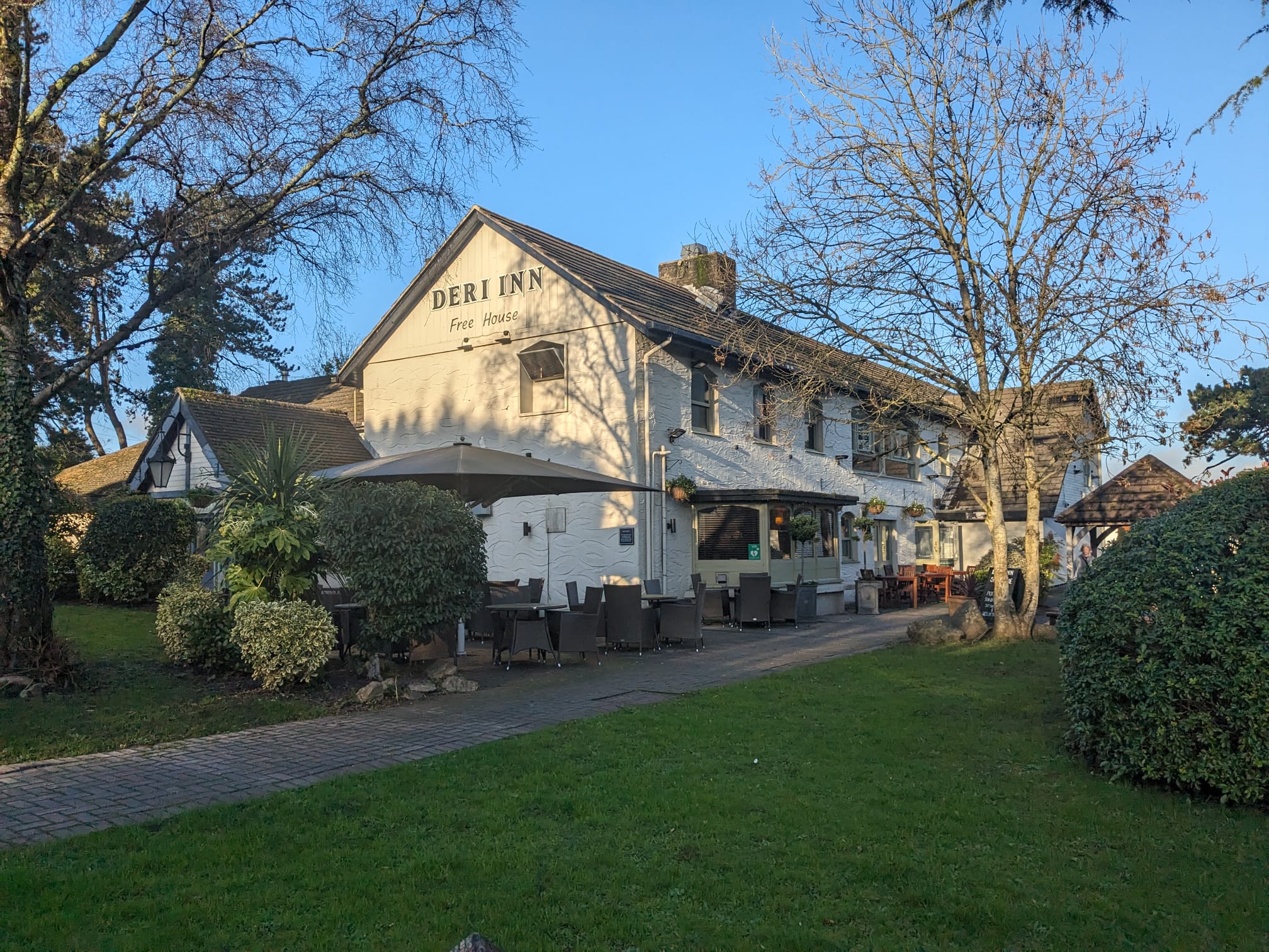
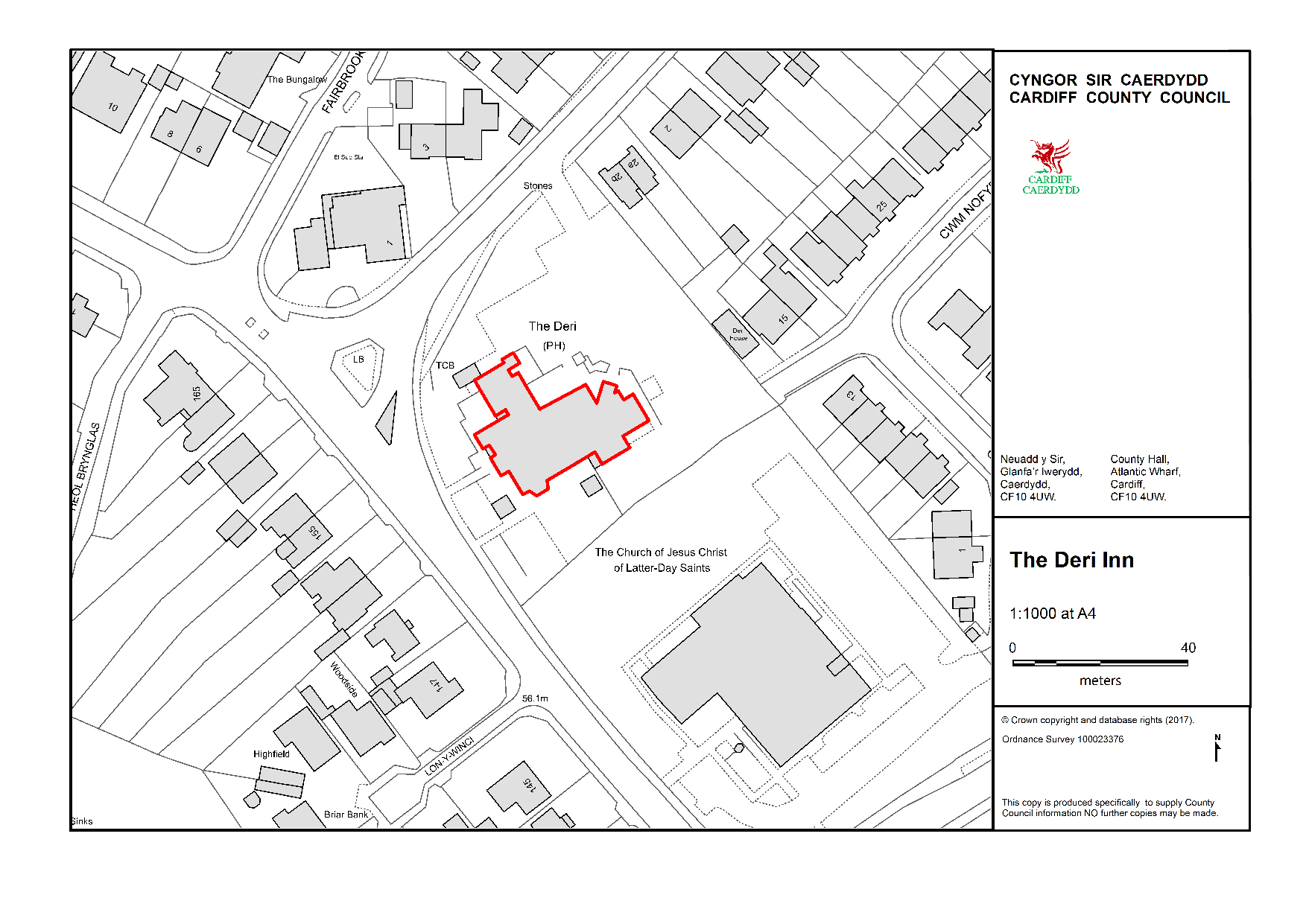
The Deri Inn sits on a prominent and generous site, located on the junction of Heol-y-Deri and Wenallt Road.
There is a large expanse of car park to the rear of the building (formerly part of the meadow of ‘Dwt Erw’). Substantial, mature trees to the boundary of the site lend clear indication of long history and former status.
The building comprises a number of intersecting two-storey parts, with principal range orientated northeast-southwest (positioned as per the former farmhouse).
A second range extends perpendicular to the north-east, with single-storey additions adjacent (both C20 in date). A short, two storey range extends from the south-western elevation, with long ‘catslide’ roof.
Much of the building has timber windows and a modern textured render. The whole is topped with a modern tile roof.
Reason
Remains of an early farmhouse may still survive at the core of the building, imparting potential for Evidential and Historical Value.
Form and positioning within a prominent site with generous grounds and a mature tree-lined border lend considerable Aesthetic Interest.
Significant remains of a farmstead with multi-generational ties to this area of Cardiff – and some 70 years of service as a public house – both impart Communal Value.
References
Glamorgan Archive
DGSR/25/31-37 Plans Showing Heol-y-Deri 1919-c1930s.
DCONC/6/40a-m
Deri House [Deri Arms] Rhiwbina with Street plans showing other licenced premises in area, 1963
Additional images
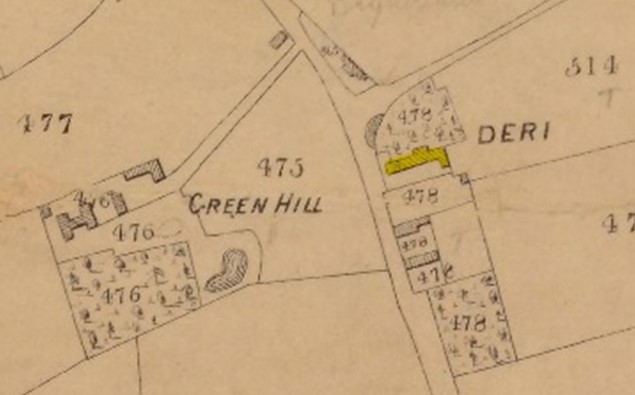
Deri Farm as shown in the Tithe Map of 1840
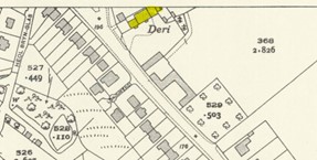
Deri Farm OS map surveyed 1941-2 (published 1946)
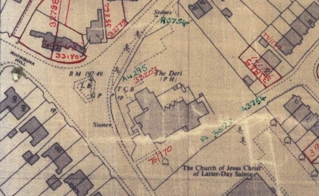
The Deri Public House OS map of 1977
